
Curbar is an hillside village, nestling beneath the gritstone ramparts of Curbar Edge. The old Packhorse route that pierced the natural gap, drops down through the heart of the village to the river Derwent, and in these days it is known as Bar road. Originally a minor Roman road, and later a turnpike road from 1759 until the demise of the turnpikes in the late 1800s.
In 1895 there were sixteen farms in Curbar, today there are non. The inhabitants in 1891, numbered 336, today the number has not changed too much, and the number is recorded at around 360.
The earliest recorded records for Curbar date back to 1203, and the name for Curbar was, Cordeburg. Translated to, “Cordas fortified place”.
The village later developed as a crossing point of the River Derwent at Stanton Ford, serving the Sheffield to Manchester packhorse trade.
The once powerful and rich Duke of Rutland, owned the village until it was sold off at the estate sale at Bakewell in 1927. Most of the tenants bought their homes at the auction, and plenty of old family names still exist in the village. Homes passed down through generations, and are still in old family ownership.
Start your journey into the past from the very busy car park at Curbar Gap. Formerly known as Curbar Bar Head, (Please use the car park and don’t block the road) now managed by the Eastern Moors Partnership.
You don’t have to walk very far to see the first remnants of the past history of Curbar. At the car park entrance, walk through the gate towards White Edge, there stands one of the old and ancient guide stoops. Erected by the parish of Curbar in 1709. You will find the name of Humphrey Gregory who was the parish surveyor carved in to the post, along with the directions to various towns. In 1697 it became an act of parliament that the local justices were instructed to erect and maintain guide posts to aid the safe journey of travelers over the lonely and desolate moors. This act did not gather momentum until 1709, when most guide posts were erected.

Before you descend Bar road, take a little time to cross over on to Baslow Edge. There you will find a viewing platform that offers superb vistas west over towards Longstone Edge and beyond. Return to Bar road which was altered when the turnpike came into being and the bend at Warren Lodge was constructed. Keep a look out for the Bible Stones, (on your left). There are four of them, but the fourth one eludes most people, and a proper search is required to discover it. These were all constructed by Edwin Gregory, mole catcher to the Duke of Devonshire. See previous post dedicated to the Bible Stones and Gregory for more information.
If you take notice of the landscape, you can still trace the outlines of the old packhorse routes. Now deep hollows in the landscape.
As you arrive at the sharp left hand bend you can’t help but notice the large house with the magnificent views west, over towards Longstone Edge. This is Warren Lodge, built 1877, and once a gamekeepers Lodge for the Duke of Rutland. So named because of the large rabbit warren that surrounded the lodge.
After the great 1927 sale, it eventually in later years became a Wardens house in the early eighties for the Peak District National Park. It stood empty for several years before finally being sold off around 2005. It is now in private ownership.

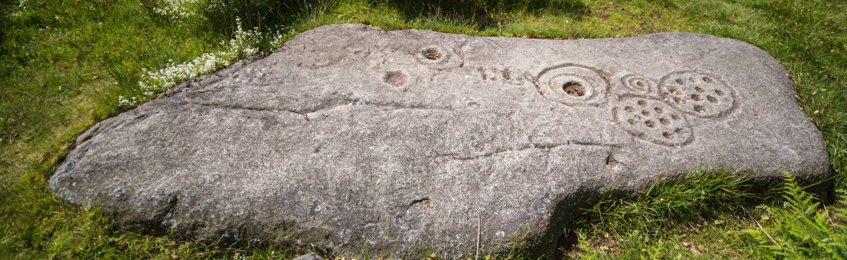
There is an interesting large boulder on the boundary of this beautiful property with a strange carving, no one knows what it signifies. Sometimes symbols to ward off evil spirits would be carved into homes. The boulder is thought be part of an old crude shelter for one of the stonemasons who worked beneath the edge. There is another stone shelter within Curbar Woods. This is known as, “Heidis Hut” but its location will remain a secret to to preserve its integrity.
A surprising fact, was the cost of transporting millstones, for instance, in 1500, the cost for transporting a pair of millstones over Baslow bridge, was 6s 8d.

Immediately below Warren Lodge and which predated the lodge, was an old croft which can be spotted on the 125:000 OS map. Shown as a small square in the line of a wall. The only information that I can find for this now ruined cottage and farm, is that it may have belonged to a Mr Peat, (nicknamed Black Jack) head gamekeeper to the Duke of Rutland after his fathers, (Edward) decease who moved into Warren Lodge, and remained there until his death.
You can still see the foundations, fire place and some walls of this derelict cotttage.

Croft below Warren Lodge
Retrace your steps to Bar road and follow it down. Before long you come to a water trough to your left. Here you will find the first Bible Stone, the rest being further up Bar road. Carry on descending until you reach the riding stables and go left on the footpath, over a stile and several gates. Keep the wall on your right, until you reach a stone squeeze stile, from there keep on the usually muddy footpath that now rises away from the wall, and you should find the Cundy graves.

The five flat stones are individually marked with the initials of the family members who sadly perished in one of the many plagues that blighted England and Europe over the centuries. This particular plague visited Curbar in 1632, thirty four years before the infamous plague of Eyam.
Thomas Cundy along with his wife Ada and three children, Olive, Nellie and Thomas, all perished in this plague and lived at Grislowfield Farm a quarter of a mile away.


Retrace your steps until arrive back at the squeeze stile and take the gate on your left. Follow the footpath, dropping down through a small field. You will shortly come to a most unusual shaped building. This square building with the stone conical roof was once the village lockup, securing prisoners overnight between Derby and Sheffield assizes. It was also rumoured to have housed prisoners from the English civil war.

There is also the story of, “Pelly the sailor” who apparently lived here in the 1920s. Here is a photo of him on the roof, holding on to a weather vane of a Galleon. The building is now in a private garden and there is no direct access. Follow the track over a stile where you will return to Bar road.

Opposite, you will see a road called The Green, take a leisurely walk down here, taking in all the different original and unique dwellings of Curbar. One building, now called, “Crifters” was once thought to have been the pub known as, “The Bulls Head”. As you near the junction of The Bent, you will notice a house boundary made up of upright oblong flag stones. These are known locally as, Moonstones. There are numerous Moonstones around the fields and properties. I have not as yet, managed to find an explanation for this name.

On the junction you will notice one of the most unusual structures of any Peak District village, The village well. This was the main water supply for the village up until around 1906, when piped water was first introduced to the village. It is a dual purpose well, with the area for human consumption enclosed within a walled area of Moonstones, this ensured that non of the animals could contaminate the supply. This is covered by a characterful stone shelter with twin doorways. The animals drank from a large stone bowl, hewed out from the local gritstone sited below the human supply, shaped like a millstone, with the water rising from below.

The Wesleylan Reform chapel is a stones throw away and was built in 1861. Constructed from local gritstone and attached to the row of cottages built 1848/50 for the workers of the cotton mill at Calver. They are now known as London Row, but once upon a time they were referred to as Club Cottages, for at one time they belonged to Calver burial club, founded 1878. With an annual subscription of 2s 6d you would be assured of a proper burial. Calver cotton Mill was used when they filmed the popular TV series, “Colditz” as the main set.
From the well, go down The Bents, and you will shortly come to the Mullions on your left. This used to be one of the two village shops, and sold everything from food to drapery supplies. This also belonged to the Duke of Rutland’s estate. One of the past owners was Mr and Mrs Ellis. It is recorded at the end of the 1800s, that a John Ellis kept 50 plus sheep on the moors and had started shepherding for his father at the age of seven, not unusual for those days.
Retrace your steps back to the well, turn right down Pinfold Hill, again numerous old dwellings adorn both sides of this road. As you reach the bottom and the junction with Curbar Lane, you will see the Pinfold directly in front of you. Most villages had a Pinfold to collect stray animals. These would be kept by the Pinder. This position was awarded to the Parish during the enclosures act. The price for recovering a stray beast was not a cheap affair, for example in 1720 the cost was around 6s 8d.

Continue your descent of Bar road to the junction where in front of you stands, “The Bridge” public house. Much altered in recent years, from the characterful interior of yesteryear.
It is on this junction that our final building worthy of mention stands in Curbar, “All Saints Church”. Consecrated in 1868 at a cost of £2,000, and built on the land where the landlord of the, “Bridge Inn” had his carpentry workshop. He also did all the carpentry on the church. It is said that he only went into the church once after helping to build it, at his funeral!

I am sure there is a wealth of further interesting information out there about Curbar, and if anyone can furnish any further information or corrections then I would love to hear from you and include it into the blog.
Acknowledgements.
Peakland Roads and Trackways, AE Dodd & EM Dodd
The Guide Stoops of Derbyshire, Howard Smith
Calver, Curbar and Froggatt, Brian Edwards
Bob James for his help with the fourth bible stone. Bob is the former head warden who lived for a time at Warren Lodge.

my family lived in Warren Lodge in the early part of the 20th Century. They were farmers. I have lots of post cards sent to my great Aunt who lived there.
LikeLike
Hi Diane, that is very interesting, what was their surname
LikeLike